CASE STUDY
Printk
UL
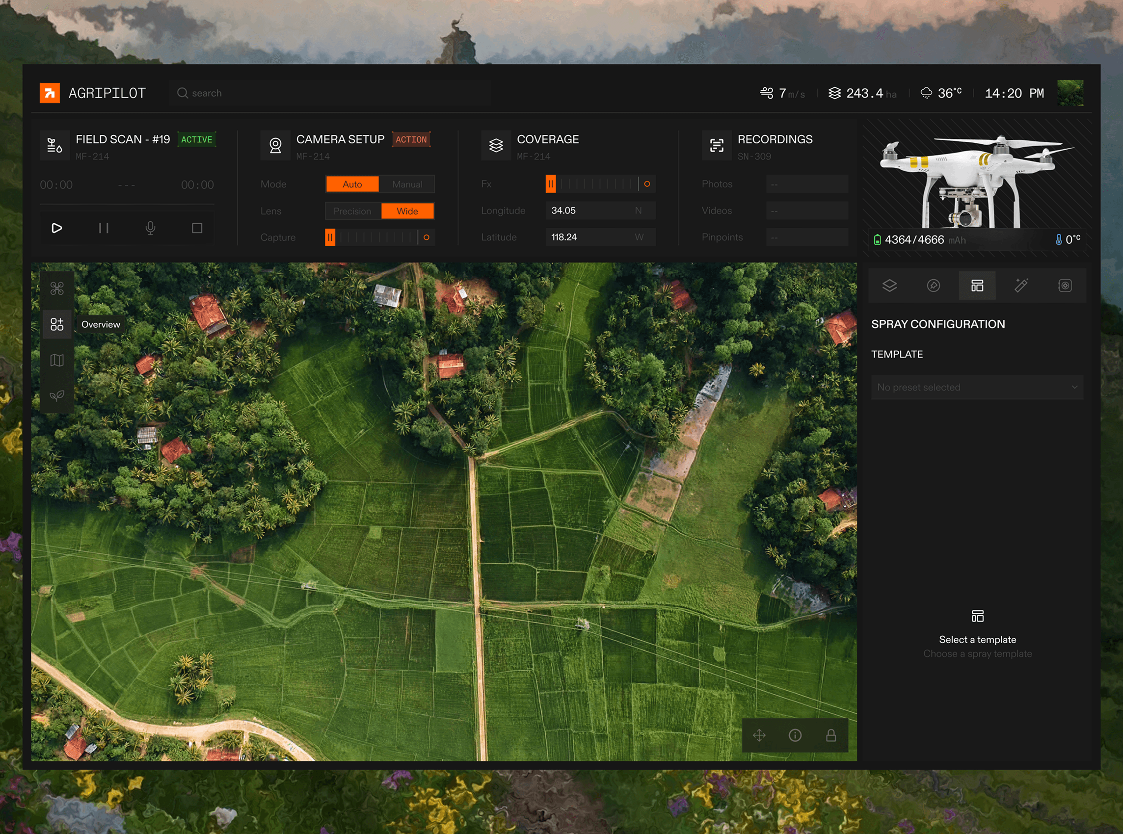
Mission-control software for precision-agriculture drone operators — unifying live field telemetry, camera feeds, and spray planning into one focused workspace.
OVERVIEW
Bringing clarity to complex field data.
Printkul’s field teams were flying drones over thousands of hectares, but the software stitching it together was scattered across spreadsheets, screenshots, and three disconnected tools.
I redesigned the operator workspace end to end — one dashboard for live scans, camera configuration, coverage mapping, and spray planning, built to stay legible at a glance in the field.
4x
FASTER FIELD SETUP
12
WEEK BUILD
243ha
AVG. COVERAGE PER SCAN
APPROACH
Three phases, one focused sprint.
001
MAP THE WORKFLOW
I SHADOWED FIELD OPERATORS TO SEE WHERE THE OLD TOOLS BROKE DOWN — MID-FLIGHT, LOW SIGNAL, GLOVES ON.
002
DESIGN FOR ONE HAND
EVERY SCREEN WAS BUILT FOR HIGH-CONTRAST OUTDOOR LIGHT AND QUICK, ONE-HANDED INPUT.
003
SHIP, MEASURE, REFINE
WE SHIPPED THE CORE DASHBOARD FIRST, THEN TIGHTENED SPRAY PLANNING AND COVERAGE TOOLS FROM REAL FLIGHT DATA.


NEXT